 |
|
HOME | The Pilots | The
Plane | Pre-Flight | Itinerary | Latest | Flight
Following
| Discussion | Newsletter | Email
![]() Join
the Ponceby Newsletter Email list for
news about the next flight
Join
the Ponceby Newsletter Email list for
news about the next flight
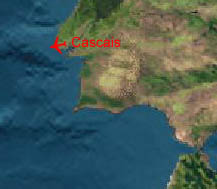
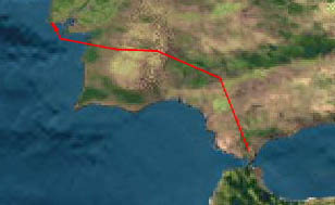
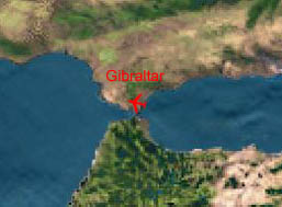
Cascais to Santa Maria Gibraltar to Cascais Malta to Gibraltar
Live Satelite Image
Satellite data provided by The Living Earth ® Inc./Earth Imaging © 1996, All Rights Reserved.
Leg 15: LXGB-LPCS Gibraltar-Cascais (Lisbon), Portugal 15 Aug 98 1.9 hours
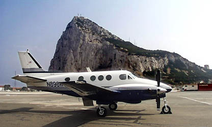
"Ponceby’s piece of the Rock"
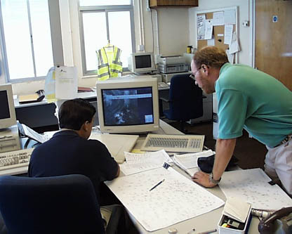
We had filed our flight plan and gotten an excellent weather briefing at the field’s met office prior to our tour. The tower advised that we would likely have a slot time for departure so that even though we had filed for 1630, departure would likely be later. (Slots are akin to flow control in the U.S. and are used to delay departures at busy times. In the U.S. they are issued only to aircraft departing for the busiest terminals, but in Europe they can be and often are issued to all IFR aircraft).
"The Weather Brief at Gibraltar"
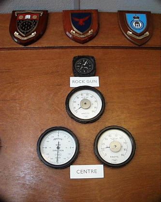
"Anemometers in the Met Office, note that one is on top of the rock itself"
We return at 1620 expecting lots of time. Unfortunately, the slot is for 1635, and we must takeoff not more than 5 minutes before or 10 minutes after that time, so again it’s rush, rush, rush. We’re delayed a few minutes in security while they set up X-Ray machines to frisk us for the second time this afternoon.
"Gibraltar tower"
ATC closes the road across the runway for our departure, then makes several amendments to our flight planned routing while we’re lining up and we’re off. We fly 20 miles south to Point ‘Charlie’, then turn right, back towards Spain. Gibraltar approach needs best rate of climb, and fortunately we are light, with wing fuel only. Before takeoff, Seville approach relays an urgent message to us through Gibraltar to avoid LD-118, a ‘danger’ area, similar to U.S. MOAs (Military Operations Areas). Shortly after takeoff, Seville calls back to say that we are cleared through all military airspace and direct to the Portugal boundary. Go figure.
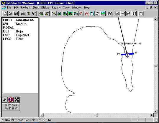
Image by FliteStar® Used By More Pilots Worldwide
"FliteStar’s Departure Area Chart, showing Gib’s 09/27 runway bisecting the peninsula."
Our flying time was just over an hour-and-a-half, one of our shortest legs so far, and seemed busy. We had done our usual flight planning kit the night before, for both Lisbon International and Cascais, using FliteStar, our flight planning software. FliteStar had the basic information on Cascais (runway length, services, frequencies), but there were no Jepp plates for this VFR airport. It is not shown on the IFR en-route charts, appearing only on the Lisbon area chart. We spent some time trying to find additional printed information on Cascais, with no joy.
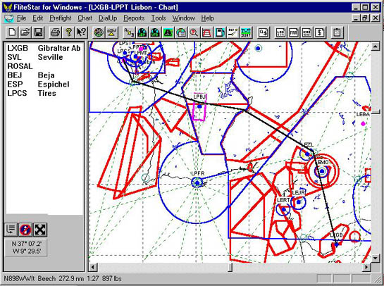
Image by FliteStar® Used By More Pilots Worldwide
"The full route chart shows our flight-planned route, and LD-118 and other special use airspace."
Lisbon International (LPPT) had had some low clouds in the morning (a few at 2,000 feet) with 7000 meters (just over 4 miles) visibility, but it was forecast to become CAVOK (ceiling and visibility OK) by late morning. The weather office in Gibraltar showed good weather at inland LPPT for our arrival around 7:30 p.m. local time, but since Cascais (LPCS) was on the coast we were concerned about the possibility of low clouds.
Image by FliteStar® Used By More Pilots Worldwide
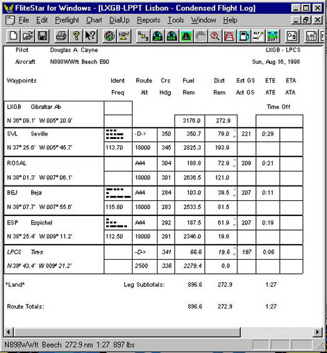
"A copy of the nav log FliteStar prints for us, the one shown here being one of the shortest so far. It includes blanks for you to write in you waypoint estimates and actual times of arrival."
We saw few clouds for most of the flight, and the recorded weather broadcast had Lisbon reporting 4,000 scattered and 9,000 broken shortly before our arrival. But as we approached Lisbon, we saw a solid undercast of coastal stratus clouds. Passing through 9,000 on our descent from 18,000 feet we saw no clouds, with a solid deck farther beneath us. The Jepp plates showed Lisbon’s approach’s minimum vectoring altitude at 2,800 feet, and we were initially cleared down to 3,000 where we were still in the clouds. Out over the water they cleared us down to 1,500 feet, and we broke out at about 2,000 feet 10 miles from the airport. As we flew inland towards the GPS coordinates, the ceiling kept sloping downwards and haze made it hard to see the airport until maybe 3 miles out. We had to fly a tight, fairly low pattern for landing on Runway 35.
Image by FliteStar® Used By More Pilots Worldwide
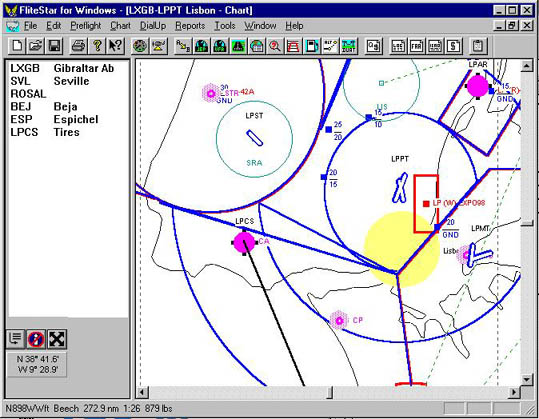
"The Lisbon area, showing Cascais near the coast."
We had called the handlers (Air Luxor) at LPPT on our way in, and they assured us that all was taken care of, with customs and immigration waiting for us at Cascais. As soon as we landed and taxied to parking on the small apron area, we knew we’d made a good choice coming to this small field. Nice, quiet, open and clean. And we had finally shaken the heat wave that had dogged us since departure. The clouds and cool temps felt GREAT when we opened the door. What a relief from blistering sun, high heat and busy, noisy large international airports!
Even though Cascais is not an AOE, the terminal had large counters for international arrivals, immigration and customs. We later saw write-ups and advertisements in magazines in the hotel suggested that Cascais is trying to expand to attract international traffic and get an instrument approach approved, but is not there yet. Entry formalities were easy, and a van was waiting to take us on the 20 minute ride to the hotel. It was the most pleasant arrival we’ve had since the start of this trip.
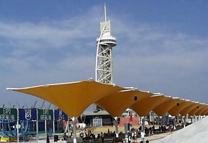
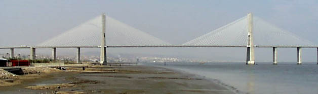
The following day was reserved for Expo 98. It came off about as expected. We saw photocopies of Leonardo’s Codex and some Porcelain. The international exhibits ranged from yellowed South Pacific travel posters taped to a wall to Turkey’s ceremonial canoe (the high point). The most interesting site was a beautiful suspension bridge upriver that appears to be the model for San Francisco’s new bay bridge.
"Expo 98"
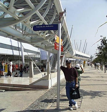
"Doug at Expo 98"
"The Bridge"
 |
Satellite data provided by The Living Earth ® Inc./Earth Imaging © 1996, All Rights Reserved.
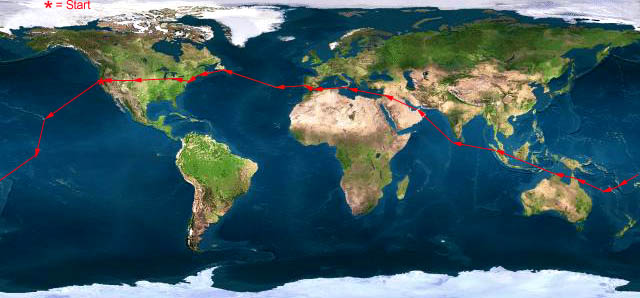
Click near each end of the red arrows for progressive reports
Click the following
Legs for Progressive Reports
|
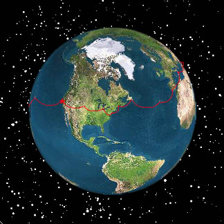
Current position of
Ponceby.
Satellite
data provided by The Living Earth
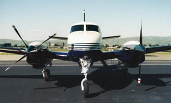
The E90 King Air "Ponceby" |
HOME | The Pilots | The Plane | Pre-Flight | Itinerary | Latest | Flight Following | Discussion | Newsletter | Email
Join the Ponceby Newsletter Email list for news about the next flight
Website Sponsored by
Webbnet - Internet Solutions