 |
|
HOME | The Pilots | The
Plane | Pre-Flight | Itinerary | Latest | Flight
Following
| Discussion | Newsletter | Email
![]() Join
the Ponceby Newsletter Email list for
news about the next flight
Join
the Ponceby Newsletter Email list for
news about the next flight
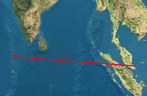
Maldives to Oman Singapore to Maldives Darwin to Singapore
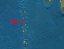
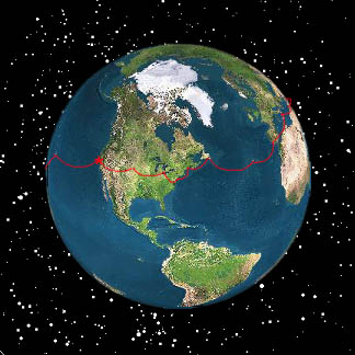
Live Satelite Image
Satellite data provided by The Living Earth ® Inc./Earth Imaging © 1996, All Rights Reserved. Leg 9: WSSL-VRMM (Seletar, Singapore to Male, The Maldive Islands) 5 Aug 98 8.9 Hours
"Male International, the Maldive Islands"
We can’t help reflecting a bit on the scale of these flights. On the Maldives flight, we consumed 3876 pounds of fuel, almost two tons. The leg time was almost 9 hours and the flight itself spanned three time zones. That is three time zones at the equator (We have made flights in the subpolar latitudes, North Atlantic crossings, that span several zones, but the Meridians are much closer near the pole).
Three separate governmental permits were required. Singapore required nothing on departure, but the States of Indonesia, Sri Lanka, and the Maldives each did. Indonesia required an overflight permit (to be arranged in advance) since we would fly over the isle of Sumatra. We didn’t actually fly over Sri Lanka, but we did fly through their sphere of influence, called an FIR or Flight Information Region. This also requires an overflight permit. Finally, The Maldive Islands require prior permission to land. Arranging these permits on your own is possible, but logistically difficult. Universal, our flight planning and weather service, takes care of this task.
On today’s flight, we reap the advantages of the decision to fly west around the globe. If we had proceeded east from the Maldives, even launching at dawn, the arrival in Singapore would have been after dark. Instead, we depart Singapore at 10 in the morning to arrive in the Maldives at 4 in the afternoon, enjoying an average tailwind of 15 knots over the flight. Quite civilized.
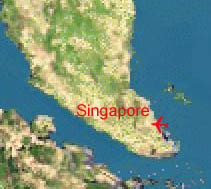
The departure is tricky. The tower asked us to come up for a mandatory briefing. Since Seletar sits between two military fields (Singapore is a small island), the tower would require an immediate right turn, and a tight downwind departure. Also, a prohibited area along our departure route (a Sultan’s palace) was in effect to 5,000 feet so the best possible rate of climb was necessary.
This would all normally be no trouble, but today’s departure was at 25 percent over the King Air’s normal gross weight, from the shortest runway that we had used to date (5300 feet) at high humidity and high ambient temperature (35C). The initial rate of climb was notably poor, and careful attention to airspeed was required in the turn due to the poor pitch stability associated with high cabin fuel loads. A vector from ATC was necessary to circumnavigate the prohibited area. Basically, it was a really fun departure.
Enroute, we are in moderate icing at level 180 (18000 feet). We request and receive a block altitude clearance on the HF from Colombo radio for levels between 180 and 240 with the intent of finding a non-icing flight level. At our weight, we can’t climb above 200 anyway (of course, one could descend as it’s not exactly cold at the surface, but one would hate to lose the nice tailwind). Fortunately, the clouds are dry here at 200 and we spend the next two hours in smooth IMC.
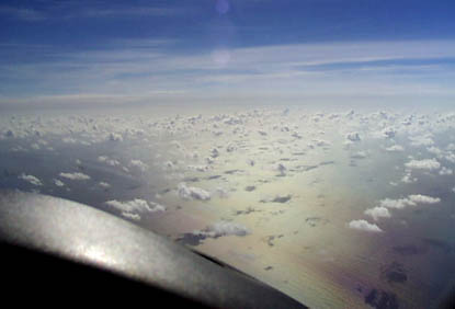
Breaking out south of Sri Lanka, the Indian Ocean is a beautiful sight.
"The Indian Ocean, just south of Sri Lanka from 20,000 feet"
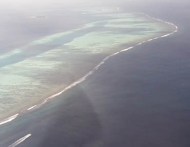
Soon, the atolls of the Maldive islands come into view. Atoll formation is an interesting process. These islands all start as volcanoes. Coral grows in the shallow oceans surrounding the volcano. Over time, the volcano is eroded and to some extent sinks under its own weight leaving just a coral atoll which continues to grow even as the volcano continues to sink. Eventually, the coral reefs themselves disappear as the sea floor itself gradually descends into the ocean trenches.
In the Maldives, the central volcanoes are gone. Only atoll reef segments are left.
"Our first sight of the Maldives, a small piece of coral reef, the North Male Atoll"
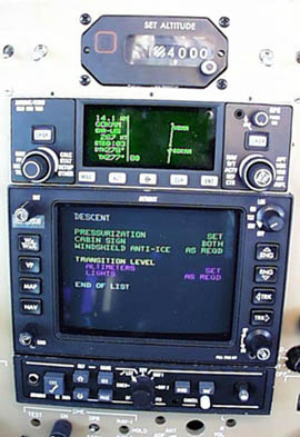
"The descent checklist, cleared to 4,000 feet"
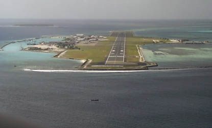
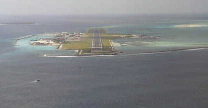
In the descent for VRMM, Male International, we are asked to fly 90 degrees of a 12 mile clockwise arc around the island airport to be followed by an ILS. Inside the marker, we’re greeted by the sight of an airport that looks like no other. One can quickly see why the last global warming conference was held in the Maldives.
"VRMM, Male International"
Shortly after we park, twelve locals run around the airplane in what appears to be total confusion. We later find that they are baggage handlers. Patience is at a premium as we are forced to restart engines to move the aircraft scarcely 30 meters for final parking.
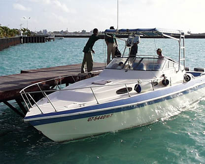
Transfer to the hotels is via speedboat. Once there, the islands are pure paradise.
"Airport-Hotel Water Taxi"
 |
Satellite data provided by The Living Earth ® Inc./Earth Imaging © 1996, All Rights Reserved.
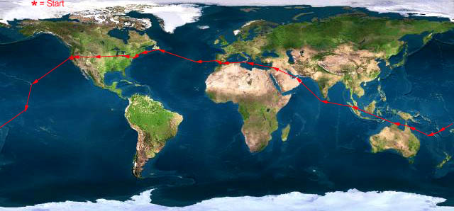
Click near each end of the red arrows for progressive reports
Click the following
Legs for Progressive Reports
|
Current position of
Ponceby.
Satellite
data provided by The Living Earth
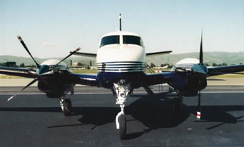
The E90 King Air "Ponceby" |
HOME | The Pilots | The Plane | Pre-Flight | Itinerary | Latest | Flight Following | Discussion | Newsletter | Email
Join the Ponceby Newsletter Email list for news about the next flight
Website Sponsored by
Webbnet - Internet Solutions